Scenes from Antarctica
Down in Antarctica, November marks the end of spring, the beginning of austral summer, and the beginning of Antarctica's cruise season. The Sun just rose for the first time in 6 months on September 22nd, and is now visible in the sky all the time. Recent studies in Antarctica have brought new insights into the origins of deep sea octopus species (a 30 million-year-old ancestor from Antarctic waters), volcanic contributions to disappearing antarctic ice, and the effects of increasing numbers of icebergs scouring the seafloor. Collected here are 32 photographs of Antarctica from the past several years. (32 photos total)
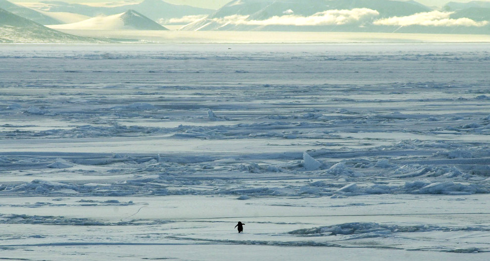
After waiting for over two weeks for his mate to return from the sea and relieve him of nest duty, this Adelie penguin's hunger helps him make the decision to abandon his egg in search of fish and krill in the sea. Photo taken December 12, 2002. Known populations of the Adelie penguin have dropped by 65% over the past 25 years. (Melanie Conner/National Science Foundation)

2
A killer whale (viewed from above) swims amid floating ice in the Ross Sea in January of 2005. Researchers from the National Oceanic and Atmospheric Administration (NOAA) Southwest Fisheries Science Center were studying the whales to determine if there are three separate species of Antarctic killer whales. (Donald LeRoi, NOAA Southwest Fisheries Science Center/National Science Foundation) #
3
Palmer Station seen from the ocean on June 10, 2006. Palmer Station is the smallest of the three U.S. Antarctic Program research stations, located on Anvers Island, near the Antarctic Peninsula. (Glenn E. Grant/National Science Foundation) #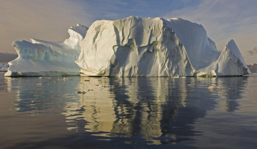
5
Sculptured iceberg in North Bay, Rothera Point, Adelaide Island, Antarctica. (© Pete Bucktrout/British Antarctic Survey) #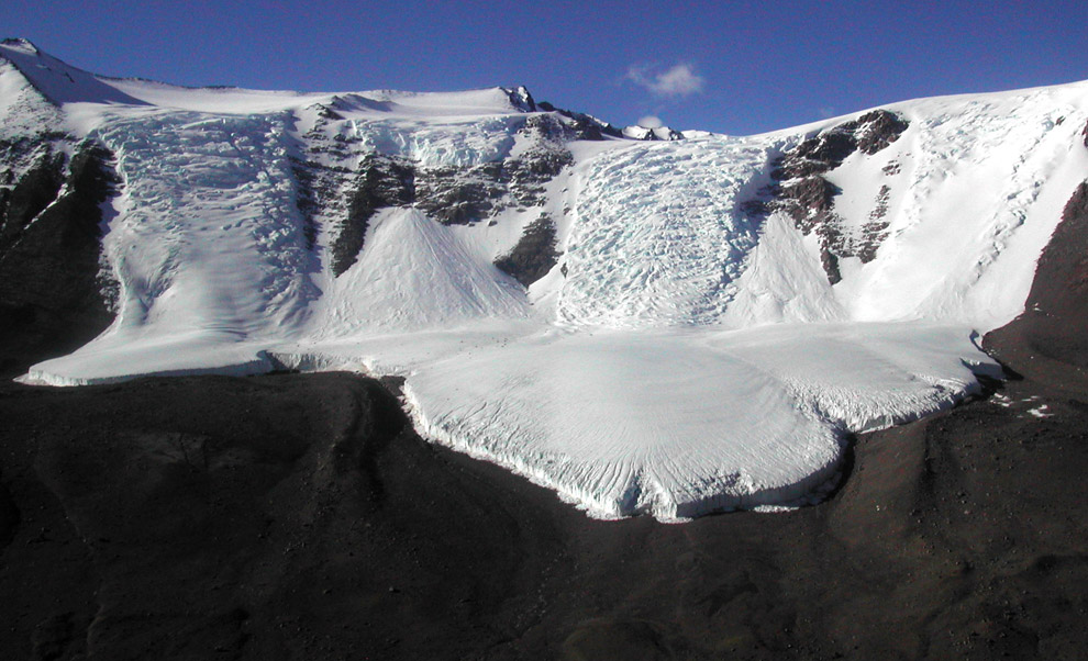
6
The Calkin Glacier, seen on November, 2003. The glacier is located in the Taylor Valley in Victoria Land, named for Parker Calkin, US Antarctic Program geologist who conducted research in the area during the 1960-61 and 1961-62 field seasons. (Brian Johnson/National Science Foundation) #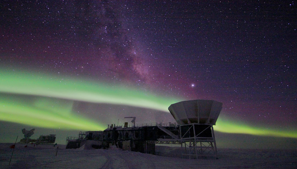
7
The aurora australis over the Dark Sector at Amundsen-Scott South Pole Station on June 3, 2008. The Dark Sector is so-named due to the absence of light and radio wave interfence. The bright spot above the ground shield in the foreground is Jupiter. The white streaks of light going up are the Milky Way. (Keith Vanderlinde/National Science Foundation) #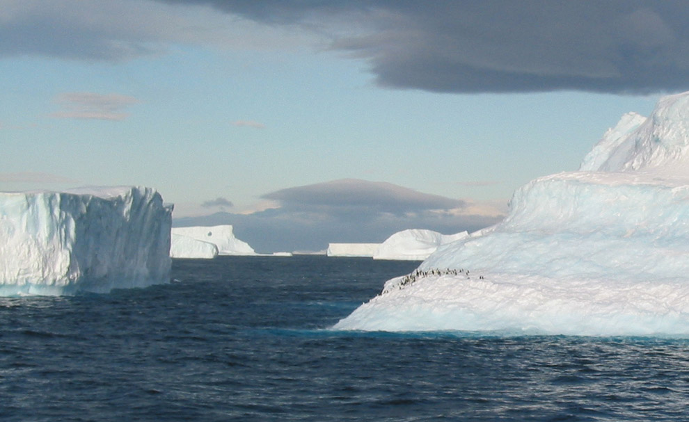
8
Penguins on a massive iceberg near the Antarctic Peninsula on November 28, 2003. (Kurtis Burmeister/National Science Foundation) #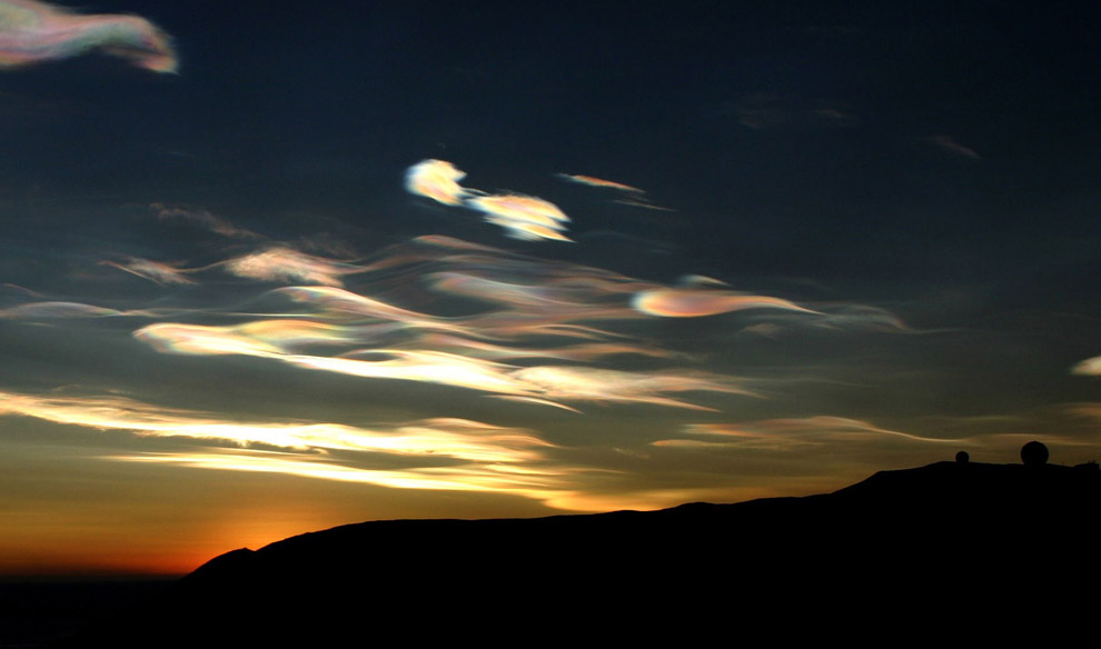
9
Nacreous clouds near McMurdo, Ross Island, Antarctica on August 28, 2004. These polar stratospheric clouds at 80,000 feet are the highest of all clouds. They only occur in the polar regions when the stratospheric temperature dips below 100 degrees below zero Fahrenheit. They are also the site of chemical reactions that break down ozone in the upper atmosphere and contribute to the creation of the ozone hole above Antarctica. (Zenobia Evans/National Science Foundation) #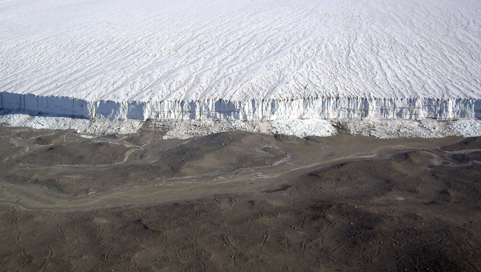
10
The Commonwealth Glacier in the Transantarctic Mountains, seen on February 4, 2007. The glacier was named by the British Antarctic Expedition led by Robert Falcon Scott (1910-1913) after the Commonwealth of Australia. This glacier flows in a southeasterly direction, west of Mount Coleman, in Victoria Land. (Mike Embree/National Science Foundation) #
11
A balancing stone seen on the Dufek Massif in the Pensacola Mountains of Antarctica on January 18, 2007. (Bill Meurer/National Science Foundation) #
12
An aurora over the Elevated Station at Amundsen-Scott South Pole Station on July 16, 2008. (Keith Vanderlinde/National Science Foundation) #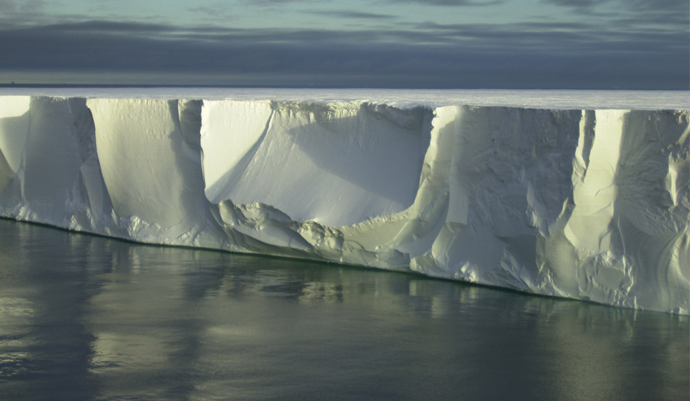
13
The northern edge of the giant iceberg B-15A seen on January 29, 2001. (Josh Landis/National Science Foundation) #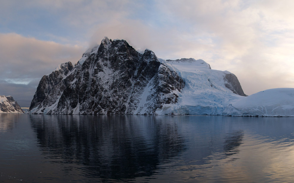
14
A view of the Antarctic coast from the Research Vessel NATHANIEL B. PALMER in April of 2007. (Patrick Rowe/National Science Foundation) #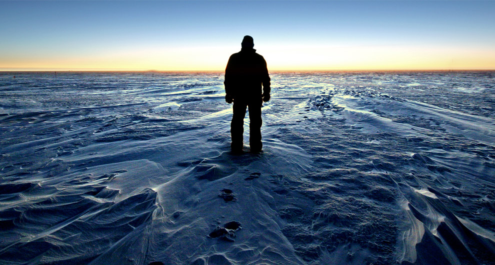
15
A person stands silhouetted by the South Pole sunset on April 6, 2008. The sun dipped below the horizon on March 20th and did not appear again until September 22nd. (Calee Allen/National Science Foundation) #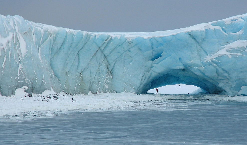
16
A person stands underneath a natural arch in a glacier at Norsel Point, Anvers Island, Antarctica on July 30, 2006. (Glenn Grant/National Science Foundation) #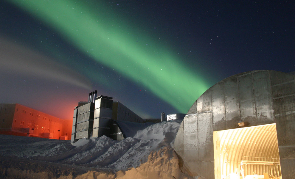
17
A full moon and 25 second exposure allowed sufficient light into this photo taken at Amundsen-Scott South Pole Station during the long Antarctic night in July of 2005. The new station can be seen at far left, power plant in the center and the old mechanic's garage in the lower right. Red lights are used outside during the winter darkness as their spectrum does not pollute the sky, allowing scientists to conduct astrophysical studies without artificial light interference. The green light in the sky is the aurora australis. (Chris Danals/National Science Foundation) #
18
The former Russian icebreaker and now cruiseliner Kapitan Khlebnikov breaks through the annual sea ice near the Oates Coast of Antarctica on January 29, 2005. (Mike Usher/National Science Foundation) #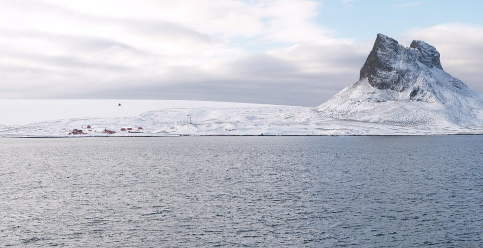
19
A view from the Research Vessel Nathaniel B. Palmer in April of 2007. (Patrick Rowe/National Science Foundation) #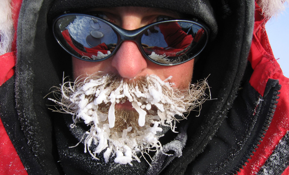
20
US Antarctic Program participant DJ Jennings shows his frozen beard on October 26, 2006. (DJ Jennings/National Science Foundation) #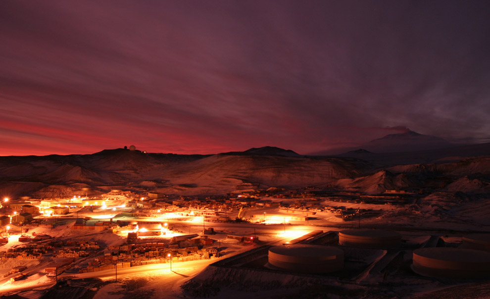
21
The first glow of sunrise appears above McMurdo Station, Ross Island, Antarctica on July 13, 2007. (Chad Carpenter/National Science Foundation) #
22
The Dome at Amundsen-Scott South Pole Station is seen above a field of sastrugi - ridges of snow formed by wind erosion on October 29, 2003. (Bill McAfee/National Science Foundation) #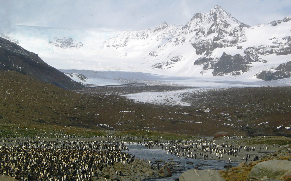
23
South Georgia Island in the South Atlantic Ocean, seen on February 23, 2006. (Melissa Rider/National Science Foundation) #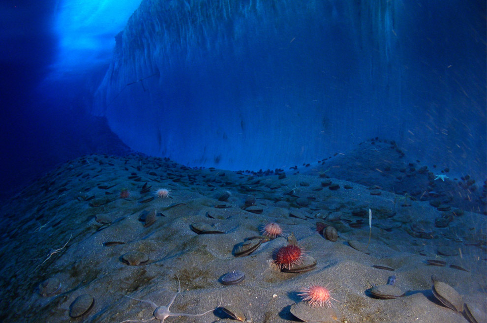
24
A cable protrudes from the ice wall at Explorer's Cover, New Harbor, McMurdo Sound in this photo taken on November 12, 2005. The cable was used for the Remotely Operable Micro-Environmental Observatory (ROMEO), an underwater camera. Connected to onshore equipment and linked by radio to the Internet, ROMEO allowed scientists to study benthic fauna year-round. (Steve Clabuesch/National Science Foundation) #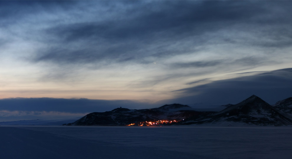
25
Ross Island as viewed from Black Island, about 25 miles away. The glow of lights of McMurdo Station (US) can be seen, and the glow of the sun just below the horizon creates a sunrise which will last for weeks. (Chad Carpenter/National Science Foundation) #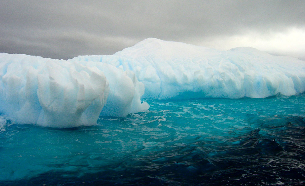
26
Icebergs near the Antarctic Peninsula in September 2002. (Jeffrey Kietzmann/National Science Foundation) #
27
An ice cave near Palmer Station, Anvers Island, Antarctica seen on July 24, 2000. (Zee Evans/National Science Foundation) #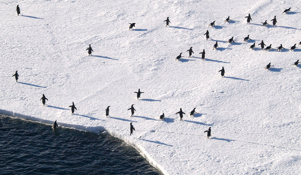
28
Adelie penguins launch themselves out of the frigid water onto the ice on December 31, 2005. (Patrick Rowe/National Science Foundation) #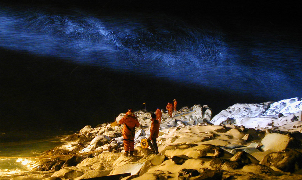
29
U.S. Antarctic Program participants handle ropes to secure the docking of a ship at Palmer Station, Anvers Island, Antarctica in the darkness of June 8, 2000. Swirling snow is illuminated above by the ship's lights. (Zee Evans/National Science Foundation) #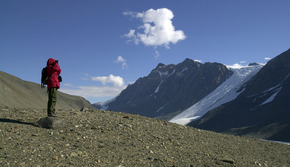
30
Soil biologist Dr. Diana Wall, Colorado State University, looks out across the Taylor Valley near Lake Hoare on January 17, 2006. Her group was conducting research on soil biota. (Emily Stone/National Science Foundation) #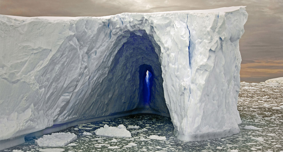
31
Brooks de Wetter-Smith's photograph of an iceberg titled "Ice Tunnel" (Courtesy of Peabody Essex Museum) #
32
The polar plateau seen on April 20, 2008. The polar plateau is comprised of a flat white snowy landscape as far as the eye can see in every direction. This photo depicts what most of Antarctica looks like - the bedrock of the continent is more than 2 miles below this snow surface. (Keith Vanderlinde/National Science Foundation) #



its just beutiful
ReplyDelete